In this episode of 80 Days: An Exploration Podcast, we’re exploring the story behind the writer of the most well-known secular Christmas song: Jingle Bells, and some of its surprising backstory. We also reflect on whether AI will replace Luke, Mark or Joe first, and take on the now-traditional festive quiz where Luke tests how much trivia from our back-catalogue we can recall. From all of us, have a very merry festive season, and we’ll see you in 2026.
Thanks to all our patrons who support the show. We really appreciate your continued backing of us. If you want to join them, more information is available at www.patreon.com/80dayspodcast
The coversheet of One Horse Open Sleigh, by James Lord Pierpont, the original title of Jingle Bells (photo from Wikimedia Commons – Public Domain)
In this episode of 80 Days: An Exploration Podcast we’ll be talking about Shetland, a group of about 100 islands, fewer than 20 of them inhabited, in Scotland, 210 km (130 miles) north of the Scottish mainland, at the northern extremity of the United Kingdom, around 340km or 210 miles from Norway. The islands total around 1,500 km2 (or 560 sq mi), making them similar in size to the nearby Faroe Islands [recommend listening to this past episode], American Samoa or Gran Canaria.
Among the settlements on Mainland, the largest island, is Scalloway, a fishing port. Lerwick, also on Mainland, is the islands’ largest town and commercial and administrative centre. The early history of the islands is dominated by the influence of the Vikings, who settled here in the 9th Century. From the 14th century, it was incorporated into the Kingdom of Scotland, and later into the United Kingdom. The climate is generally windy, cloudy and often wet, with rain falling on more than 250 days a year, and average low temperatures a little above 1 °C (34 °F) in winter and around 14 °C (57 °F) in summer.
Shetland is as far north as St Petersburg, Russia, or Anchorage, Alaska, which makes the islands an ideal place to watch the northern lights, or as they’re known locally the ‘mirrie dancers’ while in summer there is almost perpetual daylight, a state of affairs known locally as the “simmer dim”.
We had a guest on the podcast this episode, local writer, tour-guide and podcasters Laurie Goodlad, who can be found on shetlandwithlaurie.com. Thanks to Laurie for her great contributions to helping us understand Shetland, only a fraction of which is included in the episode – if you’ve fallen in love with Shetland, much more can be found in her blog and podcast episodes.
A Shetland pony photographed by Ronnie Robertson (CC-BY)The Prince of Wales set off a trend of Fair Isle jumpers, part of a general inter-war Northern Isles boost in knitting and garment industry
BBC “In Our Time” episode on the Orkneyinga Saga, which touches on Shetland (despite focussing on the Earls of the nearby Orkneys); there is no saga specifically about Shetland
Shetland Times has an article about Thomas Johnson, ancestor of the author Louis Mackey, who tells the tale of how he was press ganged by Rear Admiral Edward Thornborough and lost his legs in a battle in the Bay of Biscay, and his life after return
Thanks to all our patrons who support the show. We really appreciate your continued backing of us. If you want to join them, more information is available at www.patreon.com/80dayspodcast
In this episode of 80 Days: An Exploration Podcast, we’re exploring (in the format of festive trivia and quizzes) winter celebrations from around the world, and diving into our back-catalogue to test our memories of explorations past. Grab a cup of cocoa or egg nogg and enjoy! From all of us, have a very merry festive season, and we’ll see you in 2023.
Thanks to all our patrons who support the show. We really appreciate your continued backing of us. If you want to join them, more information is available at www.patreon.com/80dayspodcast
In this episode of 80 Days: An Exploration Podcast we’ll be talking about the Central American country Belize, formerly known as British Honduras. This small country on the Yucatan Peninsula. It is bordered by Mexico to the north, the Caribbean Sea to the east, and Guatemala to the west and south. This region was a stronghold of the Maya Heartland from around 1500BC up to the arrival of Europeans, namely the Spanish, in the 1600s. A tussle between Spain and Britain developed in subsequent decades, and Belize became a British colony in 1840, and a Crown colony in 1862, before achieving full independence in 1981. The country has an area of 22,970 square kilometres (8,867 sq mi) and a population of just over 410,000, making it similar in size to Wales, Djibouti or the US state of New Jersey, but the least densely populated nation in Central America. This is a very diverse place, ecologically, culturally and linguistically. The official language is English, but there are many other communities such as Maya, Garifuna, Creoles and even Mennonites, who speak a variety of tongues. Belize has over 400 islands or Cays off its coastline, as well as one of the world’s largest marine sinkholes, the Blue Hole, which is 318 m (1,043 ft) across and extends to a depth of 124 m (407 ft). The country also boasts the second largest barrier reef in the world after the one everyone’s heard of in Australia.
Thanks to all our patrons who support the show. We really appreciate your continued backing of us. If you want to join them, more information is available at www.patreon.com/80dayspodcast
In this episode of 80 Days: An Exploration Podcast, we’ll be talking about Burkina Faso (formerly the French Upper Volta), a landlocked country in West Africa bordered by Mali to the northwest, Niger to the northeast, Benin to the southeast, Togo and Ghana to the south, and Côte d’Ivoire to the southwest. As of 2021, the country had an estimated population of just over 20,000,000. Total land area is around 274,000 km² (or roughly 106,000 sq mi), making it slightly smaller than Italy, slightly larger than New Zealand or the US state of Colorado. Burkina Faso has a primarily tropical climate with two very distinct seasons, wet and dry. Its northern regions are in the Sahel, making them very dry and arid, while the more southern regions are cooler and more tropical.
The Mossi people, which still dominates the country today, moved into the region around 1100, and still makes up around 50% of the ethnic population. These were a tribal, agrarian society with a love of horses. Other important ethnic groups include include Fulani 8.4%, Gurma 7%, Bobo 4.9%, Gurunsi 4.6% Senufo 4.5%, Bissa 3.7%, Lobi 2.4%, Dagara 2.4%, Tuareg/Ikelan 1.9%, Dioula 0.8% (percentages of modern population). In 1896, it was colonized by the French as part of French West Africa; in 1958, a new nation named Upper Volta became a self-governing colony within the French Community. In 1960, it gained full independence with Maurice Yaméogo as president. However, since then the country has struggled to maintain political stability, with political coups or uprisings taking place in 1966, 1980, 1982, 1983, 1987, and twice in 2022.
The nation is quite poor, and is one of the world’s least-economically developed, with around 75% of people to this day living off subsistence agriculture. Burkinabe farmers are well-known for working to music, usually drums. Burkina Faso is also one of the youngest countries in the world, thanks to very high fertility (Women have on average 5 children each) and a low average life expectancy, which currently stands at just under 60, among the lowest in the world. The median age is only around 17, and this has caused a massive spike in population over the past half-century, as yearly population growth rate is more than double the world average.
The “griot” class in Mossi society are called the Bend Naaba, which transmits historical data and the head chief at Ouagadougou is called the the Moro-Naba or Mogho Naba. The legendary ancestor of the Mossi chiefs is the warrior princess Yennega (UNESCO biography).
A good starting point for learning about traditional masks in Burkinabe cultures is the Wikipedia article on Art of Burkina Faso, and various museum archives, such as Princeton
Boukary Koutou, also known as Wobgho, the Mossi King of Ouagadougou with his personal escort of Mossi cavalry, Burkina Faso. From “Du Niger au Golfe de Guinée par le pays de Kong et le Mossi” by Binger, Louis Gustave, 1892, page 35, illustrated by Édouard Riou.The Grand Mosque of Bobo-Dioulasso, Burkina Faso by JamesA (Wikimedia Commons)
Thanks to all our patrons who support the show. We really appreciate your continued backing of us. If you want to join them, more information is available at www.patreon.com/80dayspodcast
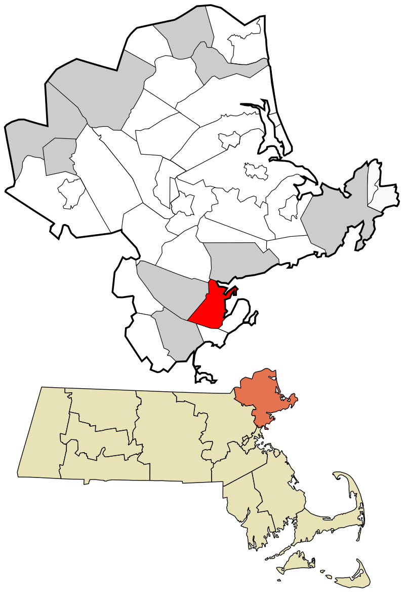
In this episode of 80 Days: An Exploration Podcast, we’ll be talking about Salem, Massachusetts, which has a strong historical connection to the famous witch trials that took place there in the 1690s. Salem lies on Massachusetts Bay between Salem Harbor and Beverly Harbor, lying alongside the Danvers River, which feeds into the harbour. It’s around 20 miles or 35 kilometres north of Boston. The witch trials took place in a small settlement just outside Salem proper then known as Salem Village, but later renamed Danvers, and we’ll likely touch on both throughout. Salem today has a population of around 44,000, while Danvers is home to around 28,000. The area had long been occupied by the indigenous Native American tribe the Massachusett before the arrival of Puritan settlers from England in the 1630s. For obvious reasons, Salem today is one of the most popular destinations in the US to celebrate Halloween, attracting over half a million visitors each year.
This Hallowe’en episode is the debut episode of Season 6. After a longer-than-planned hiatus we are back producing a new season. You’ll notice a few changes in location of your co-hosts during this season.
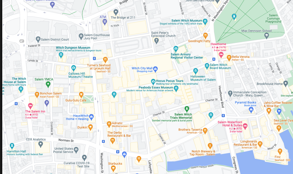
Map of Salem with an over-representation of spookily named businesses
Thanks to all our patrons who support the show. We really appreciate your continued backing of us. If you want to join them, more information is available at www.patreon.com/80dayspodcast
In this episode of 80 Days: An Exploration Podcast, we’ll be talking about the Bailiwick ofJersey, the largest of the Channel Islands lying just off the coast of Northern France. Jersey is a Crown Dependency so is not actually a part of the UK, just like the Isle of Man, which we covered in Season 1. Today, Jersey has a population of just under 100,000, and a total land area of around 120 km2 or 45 sq mi, making it a similar size to the US island of Nantucket, or slightly smaller than our old friend Liechtenstein.
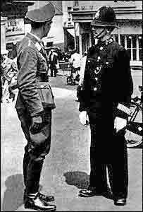
While most residents speak English and identify as British, the proximity of Jersey and the other Channel islands to France has heavily influenced their culture and their history, and French is an official second language. Jersey also has its own local language, based on French, called Jèrriais. The island was documented by the Romans, known to them as Caesarea, and was part of the Duchy of Normany until the early 13th Century, when it was reorganized and became a territory in its own right. By the end of the 15th century, Jersey was granted its own governor. An individual, now called the Lieutenant Governor, is today the personal representative of the Queen on the island. Jersey was the only part of the British Isles to be occupied by the Nazis during WW2, and was one of the last places in Europe to be liberated.
Jersey has one of the highest numbers of cars per person in the world, and because of the historical popularity of Jersey wool, knitted sweaters came to be called jerseys, after the island, with the term first recorded in 1837. And yes, this island is the namesake of the US state of New Jersey. It’s been calculated that Jersey would fit 189 times into New Jersey – 95 times if the tide is out.
Worth a watch is an ethnographic documentary on Jerriais “Music as a tool to safeguard endangered languages” by Manuela Camillo MA of Goldsmith University, London:Man Bieau P’tit Jèrriais – YouTube, which features the band Badlabecques prominently
The Death of Major Pierson, by John Singleton Copley (Battle of Jersey)The photo from the German occupation, which Luke Davis mentioned. [source]
Thanks to all our patrons who support the show. We really appreciate your continued backing of us. If you want to join them, more information is available at www.patreon.com/80dayspodcast
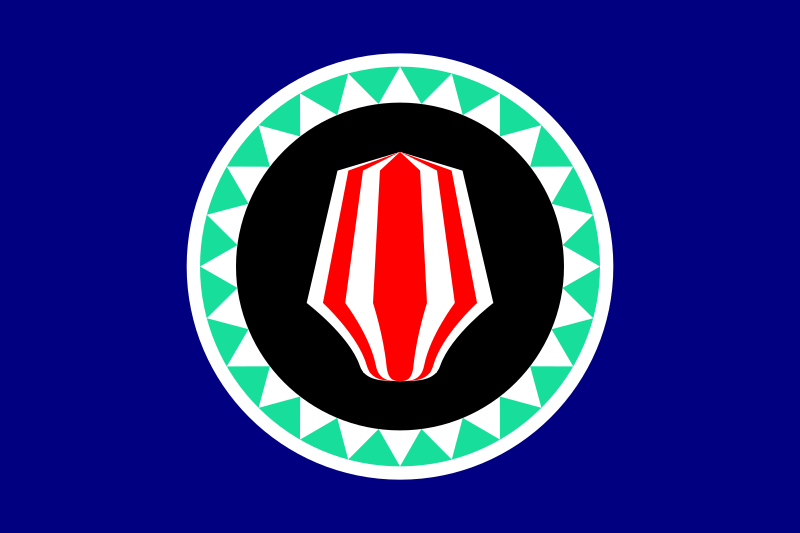
In this episode of 80 Days: An Exploration Podcast, we’ll be talking about Bougainville, the main island of the Autonomous Region of Bougainville, which is part of Papua New Guinea. Located 1,000 kilometers east of the mainland national capital of Port Moresby, Bougainville is the most remote of Papua New Guinea’s 19 provinces. Bougainville is the largest island in the Solomon Islands archipelago, lying around 1500km or 1000 miles off the northeast coast of Australia, in the Solomon Sea. Most of the islands in this archipelago (which are primarily concentrated in the southern and eastern portions of it) are part of the politically independent Solomon Islands. At around 3,500 square miles or just under 9,000 square km, Bougainville is comparable in size to Hawaii’s largest island, Puerto Rico or Cyprus. Residents speak Tok Pisim, a pidgin language spoken widely in this region, in addition to 20 different indigenous languages, depending on where they are from, and the region currently has a population of around 250,000. Inhabited by humans for at least 29,000 years, Bougainville was first discovered by Europeans in 1616, and was named for the French explorer Louis Antoine de Bougainville, one of the first people to circumnavigate the globe. The German Empire annexed present-day Bougainville in 1886, before the islands were occupied in 1914 by Australia during World War 1. Taken by Japan in 1942, the islands were fought over by both sides during the latter years of World War 2, and have retained a secessionist streak since the mid 1960s. However, tensions between different factors remain unresolved to this day, and while officially the island is today an autonomous region of Papua New Guinea, many still push for independence, particularly following a bloody 10-year civil war which concluded in 1997. A referendum in 2019 voted overwhelmingly in favour of independence, but the exact implementation of that still remains to be seen.
Flag of the Autonomous Region of Bougainville, and map of location within Papua New Guinea
We’ve also just launched a merch store in associated with TeePublic. You can find our store by clicking here, with exclusive discounts at the time of publishing.
Further information and some of the sources we consulted can be found below:
Our most valuable single source for this episode was the valuable collection of essays “Bougainville: before the conflict”, which can be found at this link
Thanks to all our patrons who support the show. We really appreciate your continued backing of us. If you want to join them, more information is available at www.patreon.com/80dayspodcast
This episode, we’d particularly like to thank new patrons, Dana Fox, AC C, Daniella Sponsler, Stepehen M, and some long-standing supporters: Emily Cranfill, Collin Macharyas, Simon Greene, Nathan Hixson, Darren Clarke, Erin Barclay and Mark Wood.
In this episode of 80 Days: an exploration podcast, we’ll be talking about Svalbard (also known as Spitsbergen), a small polar archipelago off the northern coast of Norway. Svalbard is by far the most northerly place we’ve covered on the show, lying roughly midway between continental Norway and the North Pole, around 580 miles (930 km) north of Tromsø, Norway. The archipelago consists of nine main islands, the main island being Spitsbergen, which makes up over half of the land area. In total, Svalbard has a land area of around 24,209 square miles (62,700 square km), making it similar in size to Sri Lanka or the US state of West Virginia. There are only 2,500 permanent residents here, most of whom live in the main city of Longyearbyen. First settled as an arctic whaling base in the 17th century, the islands later saw the establishment of coal mining towns, but in recent years Svalbard’s main economic lifeline has been tourism and arctic research, both of which have boomed recently. Due to its extreme northern latitude, in the summer, the sun does not set on Svalbard for 4 months, while in the winter the archipelago goes weeks without any sunlight at all. Svalbard is also notable for being home to the Global Seed Vault, while as of 2012, all residents must carry a gun while travelling outside an established settlement, in case they encounter one of the many polar bears that live nearby.
Thanks to Dr Ciaran McDonough (@metamedievalist), Sonja Murto, Aengus Ó Maoláin and Roxana Cremer (@cloudcycling) for talking to us about their first-hand experiences visiting or living in Svalbard. They were invaluable to giving us a full picture of the place.
Pack ice at Svalbard – photo by Roxana Cremer (@cloudcycling on Instagram)
Nesting birds – photo by Roxana Cremer (@cloudcycling on Instagram)
Arctic fox – photo by Roxana Cremer (@cloudcycling on Instagram)
Svalbard reindeer – photo by Roxana Cremer (@cloudcycling on Instagram)
The Svalbard coast – photo by Roxana Cremer (@cloudcycling on Instagram)
Mountains in Svalbard – photo by Roxana Cremer (@cloudcycling on Instagram)
A polar bear in Svalbard – photo by Roxana Cremer (@cloudcycling on Instagram)
The northernmost statue of Vladimir Lenin, at Pyramiden – photo by Aengus Ó Maoláin
It’s a long way from anywhere! Signposts – photo by Aengus Ó Maoláin
Some further reading:
More on the Pomors, believed to be some of the earliest inhabitants of this region can be found here.
The Svalbard Museum has a wonderful section on their website about whaling in the Arctic.
An August 1906 article in Nature entitled “The Early History of Spitsbergen” can be found here.
For more on Basque whaling, see NABO’s article here.
Svalbard-Spitsbergen.com has more reading on the charming-sounding settlement of Smeerenberg, also known as “Blubbertown”.
The article concerning Horatio Nelson’s visit to Spitsbergen can be found here.
For more on the early scientific expeditions on Svalbard, see this article from Svalbard-Spitsbergen.com
“Elegy for the Arctic” by Ludovico Einaudi is a very striking video made by Greenpeace showing the condition of the arctic ice around Svalbard as a result of climate change, which is well worth a watch.
In this minisode, Mark takes us further than we’ve ever been before, in a story that’s out of this world! From Houston, Texas, in 1968, we tell the story of the USA’s space programme and how Christmas came to be the backdrop to the first voyage by humans around the moon. Often overshadowed by Apollo 11’s Moon Landing a few months later, Apollo 8 laid vital foundations, and took place during the festive season, watched by millions of families around the world.
In addition to our theme music by the talented Thomas O’Boyle, this episode featured a lot of music and sound effects, graciously made available for free by contributors at FreeSound.org, and Free Music Archive for use under a Creative Commons license, by attribution.


.jpg)